Photogram
Selling the latest photos of Iran by Bahram Abedini
Photogram
Photogram
Latest photos by Bahram Abedini
Latest photos of Iran by Bahram Abedini
Website Language

")
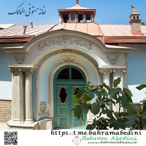
خانه مستوفی الممالک خانه ای قاجاری با قدمت صدو بیست وپنچ ساله ساله است که به نوعی نمایان گر تاریخ معاصر ایران است.
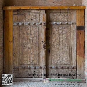
کهنترین مدارک و نمونههای در و پنجره در معماری ایران را میتوان در نقش قلعههای مادی در آثار دوره شاروقین یافت.
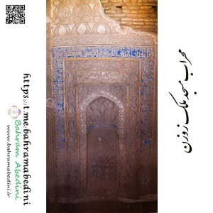
شهر در زوزن که روزگاری دارای جلال و شکوه بوده، برای زمان طولانی بنایی باشکوه و منحصر به فرد را در خود جای داده است. مسجد ملک زوزن مربوط به قرن ۷ هجری قمری، واقع در شهرستان خواف، دارای آجرکاری و کاشیکاری های بسیار ارزشمند و زیبا میباشد. این مکان در تاریخ ۲۰ بهمن ۱۳۱۸ با شمارهٔ ثبت ۳۴۰ به عنوان یکی از آثار ملی ایران به ثبت رسیده است. مسجد ملک زوزن به سبک خراسانی ساخته شده است و توسط ملک قوام الدین زوزنی، بر بقایای مسجد قبلی، در سال ۶۱۶ هجری بنا نهاده شده است. طبق بررسی های باستان شناسان در شهر تاریخی زوزن، آثاری از قرون اولیه اسلام تا دوران ایلخانی کشف شده است که بیانگر قدمت تاریخی این محدوده میباشد. بیشتر آثار بدست آمده در شهر تاریخی زوزن متعلق به قرون ۴ تا ۷ ه.ق است. این شهر در ۳۰ شهریور ۱۳۷۸ با شمارهٔ ثبت ۲۴۲۱ بهعنوان یکی از آثار ملی ایران به ثبت رسیده است.
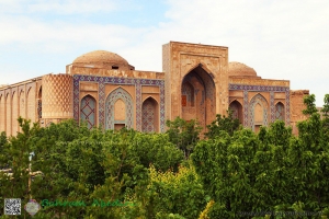
مقبره ی خواجه ربیع متعلق به دوران صفویه در شهر مقدس مشهد می باشد. این مقبره در انتهای خیابان خواجه ربیع قرار دارد و در تاریخ ۱۵ دیماه ۱۳۱۰ به شماره ی ۱۴۲ به ثبت آثار ملی ایران درآمده است. این ساختمان در دوران صفویه به توصیه ی شیخ بهایی و به دستور شاه عباس صفوی ساخته شده است.
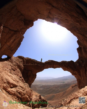
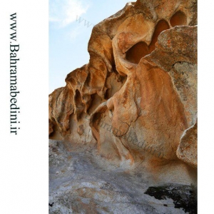
غار فارسان یا پل سنگي خضری، دشت بياض در منطقه ای بين شهرهای گناباد در خراسان رضوی و قاين در خراسان جنوبی قرار دارد كه مردم محل ، آن را «غار پارس» می نامند.
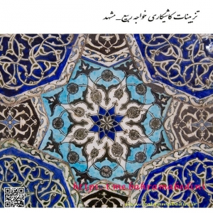
مدرسه غیاثیه خرگرد در روستای غیاثیه در ۵ کیلومتری جنوب شرقی خواف و بر سر راه تربت حیدریه در فاصله ۱۴۶ کیلومتری مشهد قرار گرفته است مدرسه غیاثیه خرگرد در روستای غیاثیه در ۵ کیلومتری جنوب شرقی خواف و بر سر راه تربت حیدریه در فاصله ۱۴۶ کیلومتری مشهد قرار گرفته است مدرسه غیاثیه اثری بر جای مانده از شهر خرگرد قدیم در خراسان (خورگرد) به معنای خورشید گرد است.
کوه های غیبی از توابع بخش احمدآباد شهرستان مشهد در خراسان رضوی میباشد. کوه های غیبی در نزدیکی ده غیبی در ۵ کیلومتری دومین کلانشهر ایران (مشهد) واقع شدهاند. با وجود آن که در تعهدات زیست محیطی سازمان ملل قید شده است که معادن باید حداقل ۶۰ کیلومتر از شهرها فاصله داشته باشند اما معادن غنی کوه های غیبی در حال حاضر بزرگترین معادن در حال استخراج سنگ گرانیت کشور هستند. در حال حاضر دوازده معدن در ارتفاعات کوه غیبی در حال فعالیت هستند.
منابع: شهرآرا آنلاین و ویکی پدیا