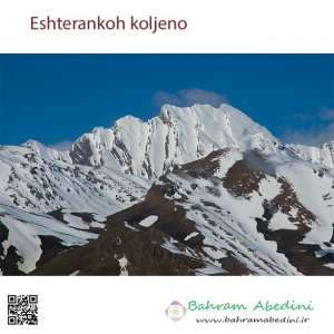
Photogram
Latest photos of Iran by Bahram Abedini
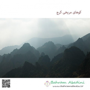
Photogram
Photogram
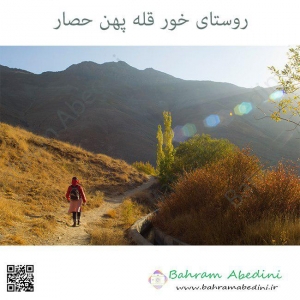
Latest photos by Bahram Abedini
Latest photos of Iran by Bahram Abedini
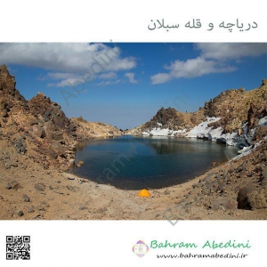
Website Language

")
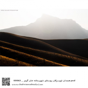
قله خان گرمز در شهر تویسرکان در نزدیکی همدان
The Mountain of Khan-garmaz
In the Vicinity of Hamedan (modern Hegmatane) the capital of the Medes.
A beautiful pristine nature with a good wildlife.
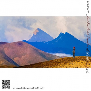
Two mountains of Azadkooh and Kaman kooh
Azad means free and kooh means mountain. So it is a free mountain or mountain of freedom .
Kaman means bow. And it looks like a bow on the left. Kaman kooh will mean bow mountain.
قله آزاد کوه و قله کمانکوه
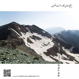
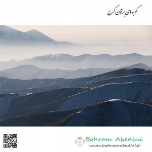
قله هفت خوان کرج از ارتفاعات البرز مرکزی در جاده چالوس قرار دارد راه دستیابی به قله از چندین مسیر اتفاق می افتد مسیر روستای اویزر که خیلی طولانی است راه روستای سپهسالار و راه آزاد بر از سمت شرق و راه گردنه عسلک که کوتاه ترین مسیر را دارد ارتفاع قله (سه هزارو نه صدو شصت و چهار ) متر با GPS دوربین عکاسی و قلل مربوط به این قله به ترتیب کرچان _میش چال _ برج میش چال _کلاش ویا _زرد بند _هفت خوان _ونتار در ادامه کهار _ میشینه نو _ وناز که یک خط الرس جذاب را تشکیل می دهد عکس فوق از یال گردنه عسلک که کمی در روی قله فرعی یعنی سبز کوه سنگهای ریزشی دارد و مسیر را دشوار می کند در تاریخ بیست وهشتم تیر ماه نودو هشت برداشته شده است.همراهان آقایان ناصر میزبانی _ قائم کیانیان _ پویا عطاران _ و غفور اندر جانی
Haft-khaan Karaj Peak from Central Alborz Heights Located on Chalus Road The road to reach the summit from several routes Ovezer Village Road which is very long Sepahsalar village road and east road and the shortest honeycomb road. Peak height (three thousand nine hundred and sixty-four) meters with GPS camera and peaks related to this peak in Kerchan - Mishal Chal - Mish Chal - Clash or Zardash - Seven Readers - Seven Readers - Continental Kahar - Mishin Noor - Venaz which is a ridge This is a photo of a honeycomb trailer that has a bit of a pebble on the side of the mountain, making the route difficult. Dated on July 28, the eighth day of July, the eighth day has been removed. The companions of Mr. Nasser Hosting - Ghaem Kianian - Pouya Attaran - and Gafour Andrew Jani
کوه های غیبی از توابع بخش احمدآباد شهرستان مشهد در خراسان رضوی میباشد. کوه های غیبی در نزدیکی ده غیبی در ۵ کیلومتری دومین کلانشهر ایران (مشهد) واقع شدهاند. با وجود آن که در تعهدات زیست محیطی سازمان ملل قید شده است که معادن باید حداقل ۶۰ کیلومتر از شهرها فاصله داشته باشند اما معادن غنی کوه های غیبی در حال حاضر بزرگترین معادن در حال استخراج سنگ گرانیت کشور هستند. در حال حاضر دوازده معدن در ارتفاعات کوه غیبی در حال فعالیت هستند.
منابع: شهرآرا آنلاین و ویکی پدیا
منطقه ساوجبلاغ شمالی دارای آب وهوای خنک در تابستان و در زمستان سرد روستاهای برقان اغشت سنج کردان سیرود ولیان همگی در کوهپایه های البرز مرکزی قرار دارد ودارای کوهایی به ارتفاع سه هزار تا چهار هزار متر که بلندترین آن ناز کهار به ارتفاع جهارو صدو پنچاه متر می باشد همچنین دارای آبشارهای فراوان از قبیل آبشارهای سنج -وارش کرور - جوزدره - سیرود - ولیان - سوته دره فشند والا دیگر این عکس در بهمن ماه نودو شش از روی گوهای دوروان گرفته شده است
The northern Savojbolagh region has cool weathers in the summer, and is cold in winters. the villages of Baraghan, Senj, Kordan, Sirood, and Valyan are all located in the foothills of the central Alborz, with a quay of three thousand to four thousand meters, the tallest of which is cute with a height of about one hundred and five feet Also, there are many waterfalls such as waterfalls of the mosque - Korur - Josedra - Syroud - Valian - Suet Valley of Fashand Valah. The other image was taken in February of the ninety sixth of Dowwan's circle
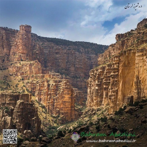
شیرز دره ای در کوهدشت لرستان مرز بین سه استان کرمانشاه لرستان وکردستان دره ای با صخرهای سر به فلک کشیده رودخانه با آب زلال آبشار غار و برج سنگی معروف یکی از بکر ترین مناطق ایران است مردم کوهدشت بیشتر دامداری وکشاورزی می کنند ولی اهالی سیاه چادر ها به کار دامداری مشغول هستند و بسیار مهمانواز.............. این عکس در بهار 95 به ثبت رسیده است
Shirz valley in Kohdasht Lorestan border between the three provinces of Kermanshah Lorestan and Kurdistan with a cliff-climbed river with a clear water of the cascade of the Qar and a famous stone tower is one of the most pristine regions of Iran. Kowhdasht people are most into agriculture, but the people of black tents (gypsies) are busy with livestock and are very hospitable .............. This photo was recorded in the spring of 2016.